
Lierna topographic map
Interactive map
Click on the map to display elevation.
About this map
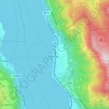
Name: Lierna topographic map, elevation, terrain.
Location: Lierna, LC, Lombardy, 23827, Italy (45.94250 9.28360 45.97779 9.35624)
Average elevation: 643 m
Minimum elevation: 189 m
Maximum elevation: 1,678 m