Geolocate

Ancona topographic map

Click on the map to display elevation.

About this map
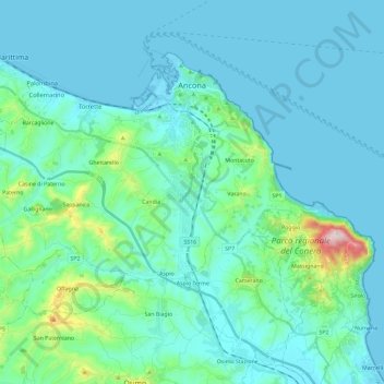
Name: Ancona topographic map, elevation, terrain.

Location: Ancona, Marche, Italy (43.50855 13.37618 43.63146 13.60906)

Average elevation: 72 m

Minimum elevation: -5 m

Maximum elevation: 566 m

Other topographic maps

Click on a map to view its topography, its elevation and its terrain.

Montignano-Marzocca

Italy > Marche > Ancona > Senigallia

Average elevation: 26 m

Gear up for your next adventure:

🎒Hiking Backpacks - Comfortable backpacks for day hikes and multi-day treks
🕶️Polarized Sunglasses - Reduces glare from snow and water when reading terrain
👟Men's Trail Running Shoes - Lightweight grip for fast movement over topographic contours
👖Hiking Trousers - Durable trousers designed for rough terrain
🧭GPS Trackers - Tracking devices for safety and navigation

As an Amazon Associate, this site earns from qualifying purchases at no extra cost to you.