
Fasanenhof topographic map
Interactive map
Click on the map to display elevation.
About this map
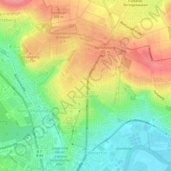
Name: Fasanenhof topographic map, elevation, terrain.
Location: Fasanenhof, Kassel, Regierungsbezirk Kassel, Hessen, Deutschland (51.32514 9.50052 51.34385 9.52419)
Average elevation: 175 m
Minimum elevation: 134 m
Maximum elevation: 220 m
Other topographic maps
Click on a map to view its topography, its elevation and its terrain.