
Vålberg topographic map
Interactive map
Click on the map to display elevation.
About this map
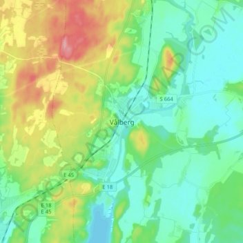
Name: Vålberg topographic map, elevation, terrain.
Location: Vålberg, Karlstads kommun, Värmlands län, Svealand, Zweden (59.35538 13.15347 59.43538 13.23347)
Average elevation: 75 m
Minimum elevation: 42 m
Maximum elevation: 153 m