
Kaev Seima topographic map
Interactive map
Click on the map to display elevation.
About this map
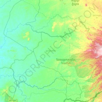
Name: Kaev Seima topographic map, elevation, terrain.
Location: Kaev Seima, Mondulkiri, Cambodia (12.06146 106.35878 12.75752 107.04468)
Average elevation: 143 m
Minimum elevation: 39 m
Maximum elevation: 574 m
Other topographic maps
Click on a map to view its topography, its elevation and its terrain.