
Toungup Township topographic map
Interactive map
Click on the map to display elevation.
About this map
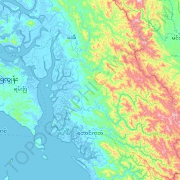
Name: Toungup Township topographic map, elevation, terrain.
Location: Toungup Township, Thandwe District, Rakhine, Myanmar (18.62185 93.99455 19.53834 94.76197)
Average elevation: 229 m
Minimum elevation: -6 m
Maximum elevation: 1,458 m