
Camp Soubran topographic map
Interactive map
Click on the map to display elevation.
About this map
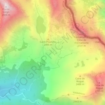
Name: Camp Soubran topographic map, elevation, terrain.
Average elevation: 2,347 m
Minimum elevation: 1,884 m
Maximum elevation: 2,861 m
Other topographic maps
Click on a map to view its topography, its elevation and its terrain.
Mollières
France > Provence-Alpes-Côte d'Azur > Alpes-Maritimes > Valdeblore
Mollières, Valdeblore, Nice, Alpes-Maritimes, Provence-Alpes-Côte d'Azur, France métropolitaine, 06420, France
Average elevation: 1,971 m
Pic de la Colmiane
France > Provence-Alpes-Côte d'Azur > Alpes-Maritimes > Valdeblore
Pic de la Colmiane, Valdeblore, Nice, Alpes-Maritimes, Provence-Alpes-Côte d'Azur, France métropolitaine, 06420, France
Average elevation: 1,531 m