Geolocate

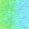
Grabagan topographic map

Click on the map to display elevation.

About this map

Name: Grabagan topographic map, elevation, terrain.

Location: Grabagan, Tulangan, Sidoarjo, East Java, Java, 61261, Indonesia (-7.47059 112.60588 -7.43059 112.64588)

Average elevation: 10 m

Minimum elevation: 6 m

Maximum elevation: 13 m

Other topographic maps

Click on a map to view its topography, its elevation and its terrain.
Jabon

Indonesia > East Java > Sidoarjo

Average elevation: 3 m

Candi

Indonesia > East Java > Sidoarjo

Average elevation: 3 m

Tulangan

Indonesia > East Java > Sidoarjo

Average elevation: 8 m

Sukodono

Indonesia > East Java > Sidoarjo

Average elevation: 8 m

Krembung

Indonesia > East Java > Sidoarjo

Average elevation: 10 m

Prambon

Indonesia > East Java > Sidoarjo

Average elevation: 13 m

Tanggulangin

Indonesia > East Java > Sidoarjo

Average elevation: 3 m

Gear up for your next adventure:

🛰️Handheld GPS Devices - Reliable GPS units for hiking and outdoor navigation
❄️Walking Crampons - Added traction for icy slopes and winter peak bagging
🥾Hiking Boots - Waterproof and durable boots for long-distance hiking in the UK
🎒Hiking Daypacks (20L) - Compact backpacks for day trips and technical mountain ascents
🧺Mesh Stuff Sacks - Breathable storage for wet gear or camp organization

As an Amazon Associate, this site earns from qualifying purchases at no extra cost to you.