
Thank you for supporting this site ❤️
Make a donation
Make a donation
Gear up for your next adventure:
As an Amazon Associate, this site earns from qualifying purchases at no extra cost to you.
Geben topographic map
Click on the map to display elevation.
Thank you for supporting this site ❤️
Make a donation
Make a donation
Gear up for your next adventure:
As an Amazon Associate, this site earns from qualifying purchases at no extra cost to you.
About this map
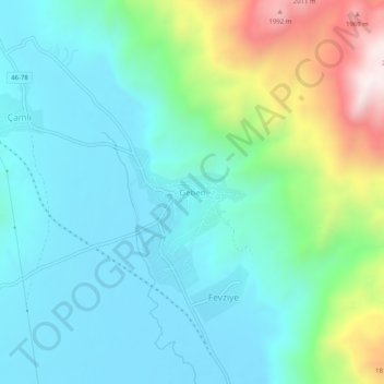
Name: Geben topographic map, elevation, terrain.
Location: Geben, Andırın, Kahramanmaraş, Mediterranean Region, Turkey (37.76392 36.42849 37.80392 36.46849)
Average elevation: 1,457 m
Minimum elevation: 1,260 m
Maximum elevation: 2,082 m
Thank you for supporting this site ❤️
Make a donation
Make a donation
Gear up for your next adventure:
As an Amazon Associate, this site earns from qualifying purchases at no extra cost to you.