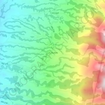
Las Nubes topographic map
Interactive map
Click on the map to display elevation.
About this map
Name: Las Nubes topographic map, elevation, terrain.
Average elevation: 1,795 m
Minimum elevation: 1,532 m
Maximum elevation: 2,306 m

Click on the map to display elevation.
Name: Las Nubes topographic map, elevation, terrain.
Average elevation: 1,795 m
Minimum elevation: 1,532 m
Maximum elevation: 2,306 m