
Thank you for supporting this site ❤️
Make a donation
Make a donation
Gear up for your next adventure:
As an Amazon Associate, this site earns from qualifying purchases at no extra cost to you.
Wingham topographic map
Click on the map to display elevation.
Thank you for supporting this site ❤️
Make a donation
Make a donation
Gear up for your next adventure:
As an Amazon Associate, this site earns from qualifying purchases at no extra cost to you.
About this map
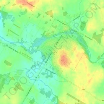
Name: Wingham topographic map, elevation, terrain.
Location: Wingham, North Huron, Huron County, Ontario, N0G 2W0, Canada (43.86625 -81.33275 43.90625 -81.29275)
Average elevation: 318 m
Minimum elevation: 298 m
Maximum elevation: 342 m
Thank you for supporting this site ❤️
Make a donation
Make a donation
Gear up for your next adventure:
As an Amazon Associate, this site earns from qualifying purchases at no extra cost to you.