Geolocate

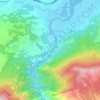
Radishani topographic map

Click on the map to display elevation.

About this map

Name: Radishani topographic map, elevation, terrain.

Location: Radishani, Municipality of Butel, City of Skopje, North Macedonia (42.04193 21.44235 42.08696 21.46745)

Average elevation: 402 m

Minimum elevation: 301 m

Maximum elevation: 650 m

Other topographic maps

Click on a map to view its topography, its elevation and its terrain.
Dolna Matka

North Macedonia > City of Skopje

Average elevation: 504 m

Ѓафа

North Macedonia > City of Skopje > Strachinci

Average elevation: 899 m

Gear up for your next adventure:

⛺Camping Shelters - Emergency and lightweight shelters for outdoor use
🛰️Handheld GPS Devices - Reliable GPS units for hiking and outdoor navigation
🧭GPS Trackers - Tracking devices for safety and navigation
🧦Hiking Socks - Breathable socks designed to prevent blisters on long walks
📷Camera Straps - Secure straps for carrying cameras while walking

As an Amazon Associate, this site earns from qualifying purchases at no extra cost to you.