
Thank you for supporting this site ❤️
Make a donation
Make a donation
Gear up for your next adventure:
As an Amazon Associate, this site earns from qualifying purchases at no extra cost to you.
Kappimala topographic map
Click on the map to display elevation.
Thank you for supporting this site ❤️
Make a donation
Make a donation
Gear up for your next adventure:
As an Amazon Associate, this site earns from qualifying purchases at no extra cost to you.
About this map
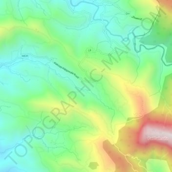
Name: Kappimala topographic map, elevation, terrain.
Location: Kappimala, Manjapullu, Taliparamba, Kannur, Kerala, India (12.17913 75.49424 12.20273 75.54758)
Average elevation: 466 m
Minimum elevation: 88 m
Maximum elevation: 1,216 m
Thank you for supporting this site ❤️
Make a donation
Make a donation
Gear up for your next adventure:
As an Amazon Associate, this site earns from qualifying purchases at no extra cost to you.