
Sisa topographic map
Interactive map
Click on the map to display elevation.
About this map
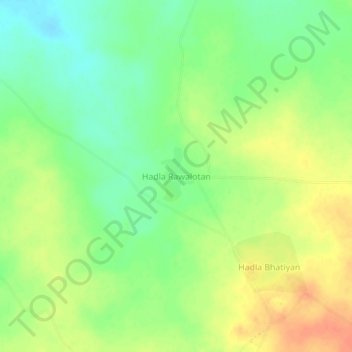
Name: Sisa topographic map, elevation, terrain.
Location: Sisa, Kolayat Tehsil, Bikaner, Rajastán, India (27.79465 73.01633 27.83465 73.05633)
Average elevation: 264 m
Minimum elevation: 243 m
Maximum elevation: 285 m