
Argyle Shore topographic map
Interactive map
Click on the map to display elevation.
About this map
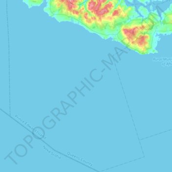
Name: Argyle Shore topographic map, elevation, terrain.
Location: Argyle Shore, Queens County, Prince Edward Island, Canada (45.98523 -63.43010 46.19619 -63.24723)
Average elevation: 4 m
Minimum elevation: -2 m
Maximum elevation: 90 m
Other topographic maps
Click on a map to view its topography, its elevation and its terrain.