
Kampong Murai topographic map
Interactive map
Click on the map to display elevation.
About this map
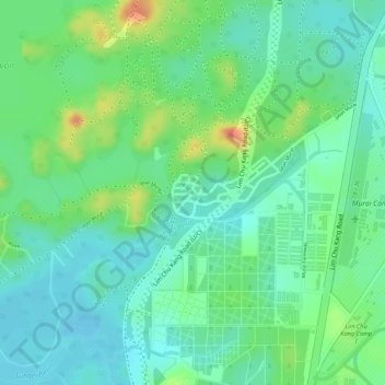
Name: Kampong Murai topographic map, elevation, terrain.
Average elevation: 19 m
Minimum elevation: -2 m
Maximum elevation: 55 m
Other topographic maps
Click on a map to view its topography, its elevation and its terrain.
Kranji Marshes
Kranji Marshes, Lim Chu Kang, Southwest, 718814, Singapore
Average elevation: 7 m