
Zmeiovo topographic map
Interactive map
Click on the map to display elevation.
About this map
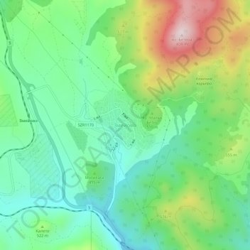
Name: Zmeiovo topographic map, elevation, terrain.
Location: Zmeiovo, Stara Zagora, Bulgaria (42.47707 25.59695 42.51707 25.63695)
Average elevation: 484 m
Minimum elevation: 330 m
Maximum elevation: 798 m