
Pukë topographic map
Interactive map
Click on the map to display elevation.
About this map
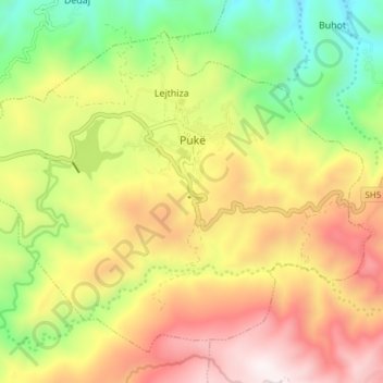
Name: Pukë topographic map, elevation, terrain.
Average elevation: 798 m
Minimum elevation: 322 m
Maximum elevation: 1,316 m
At 838 metres above sea level, the town is one of the highest in elevation in Albania and a well-known ski area. It is 150 km from Albania's capital, Tirana.