
High Hoyland topographic map
Interactive map
Click on the map to display elevation.
About this map
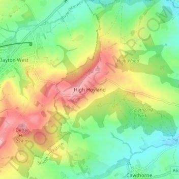
Name: High Hoyland topographic map, elevation, terrain.
Average elevation: 133 m
Minimum elevation: 68 m
Maximum elevation: 227 m
High Hoyland is a village and civil parish in the Metropolitan Borough of Barnsley in South Yorkshire, England, on the border with West Yorkshire. It lies to the west of Kexbrough, and is located at approximately 53°35′10″N 1°35′30″W / 53.58611°N 1.59167°W / 53.58611; -1.59167, at an elevation of around 200 metres above sea level. At the 2001 census it had a population of 142, reducing to 128 at the 2011 Census.