
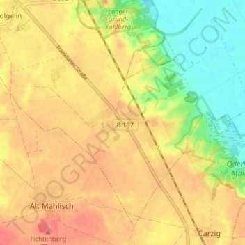
Libbenichen topographic map
Interactive map
Click on the map to display elevation.
About this map
Name: Libbenichen topographic map, elevation, terrain.
Average elevation: 45 m
Minimum elevation: 7 m
Maximum elevation: 72 m
Other topographic maps
Click on a map to view its topography, its elevation and its terrain.
Dolgelin
Deutschland > Brandenburg > Märkisch-Oderland > Lindendorf
Dolgelin, Lindendorf, Seelow-Land, Märkisch-Oderland, Brandenburg, 15306, Deutschland
Average elevation: 50 m
Friedenstal
Deutschland > Brandenburg > Märkisch-Oderland > Lindendorf > Friedenstal
Friedenstal, Lindendorf, Seelow-Land, Märkisch-Oderland, Brandenburg, Deutschland
Average elevation: 23 m
Lindendorf
Deutschland > Brandenburg > Märkisch-Oderland > Lindendorf
Lindendorf, Seelow-Land, Märkisch-Oderland, Brandenburg, 15306, Deutschland
Average elevation: 34 m