
Cantón Guácimo topographic map
Interactive map
Click on the map to display elevation.
About this map
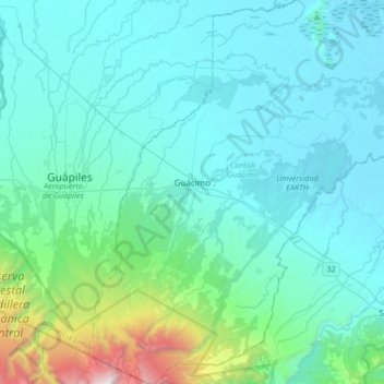
Name: Cantón Guácimo topographic map, elevation, terrain.
Location: Cantón Guácimo, Limón Province, Costa Rica (10.03871 -83.77486 10.36613 -83.46991)
Average elevation: 356 m
Minimum elevation: 4 m
Maximum elevation: 2,814 m
Guácimo has an area of 576.48 km² and a mean elevation of 67 metres.