
Azeffoun topographic map
Interactive map
Click on the map to display elevation.
About this map
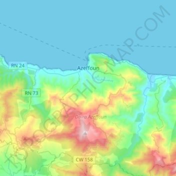
Name: Azeffoun topographic map, elevation, terrain.
Location: Azeffoun, Azeffoun District, Tizi Ouzou, 15045, Algeria (36.82918 4.26278 36.91074 4.51367)
Average elevation: 258 m
Minimum elevation: -2 m
Maximum elevation: 1,259 m