
Vík topographic map
Interactive map
Click on the map to display elevation.
About this map
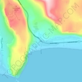
Name: Vík topographic map, elevation, terrain.
Location: Vík, Mýrdalshreppur, Suðurland, 870, Islande (63.39882 -19.02547 63.43882 -18.98547)
Average elevation: 106 m
Minimum elevation: -3 m
Maximum elevation: 384 m
Other topographic maps
Click on a map to view its topography, its elevation and its terrain.