
Pic Tyndall topographic map
Interactive map
Click on the map to display elevation.
About this map
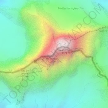
Name: Pic Tyndall topographic map, elevation, terrain.
Location: Pic Tyndall, Valtournenche, Valle d'Aosta, Italia (45.97474 7.65434 45.97484 7.65444)
Average elevation: 3,289 m
Minimum elevation: 2,759 m
Maximum elevation: 4,389 m