
Thank you for supporting this site ❤️
Make a donation
Make a donation
Gear up for your next adventure:
As an Amazon Associate, this site earns from qualifying purchases at no extra cost to you.
Vejegaon topographic map
Click on the map to display elevation.
Thank you for supporting this site ❤️
Make a donation
Make a donation
Gear up for your next adventure:
As an Amazon Associate, this site earns from qualifying purchases at no extra cost to you.
About this map
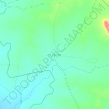
Name: Vejegaon topographic map, elevation, terrain.
Location: Vejegaon, Khanapur, Sangli, Maharashtra, 415310, India (17.35722 74.56974 17.39722 74.60974)
Average elevation: 720 m
Minimum elevation: 686 m
Maximum elevation: 829 m
Thank you for supporting this site ❤️
Make a donation
Make a donation
Gear up for your next adventure:
As an Amazon Associate, this site earns from qualifying purchases at no extra cost to you.