
Parzán topographic map
Interactive map
Click on the map to display elevation.
About this map
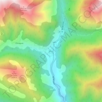
Name: Parzán topographic map, elevation, terrain.
Location: Parzán, Bielsa, Sobrarbe, Aragón, 22365, Spanje (42.64052 0.18804 42.68052 0.22804)
Average elevation: 1,552 m
Minimum elevation: 1,044 m
Maximum elevation: 2,306 m
Other topographic maps
Click on a map to view its topography, its elevation and its terrain.