
Hà Rai topographic map
Interactive map
Click on the map to display elevation.
About this map
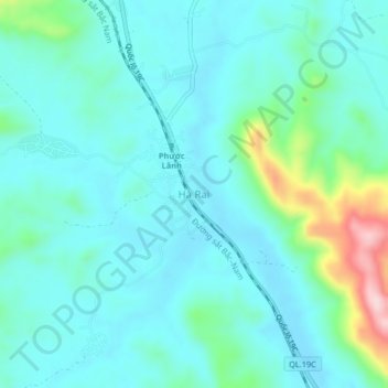
Name: Hà Rai topographic map, elevation, terrain.
Location: Hà Rai, Đồng Xuân District, Phú Yên Province, Vietnam (13.46087 109.01379 13.50087 109.05379)
Average elevation: 73 m
Minimum elevation: 27 m
Maximum elevation: 279 m