
La Motte topographic map
Interactive map
Click on the map to display elevation.
About this map
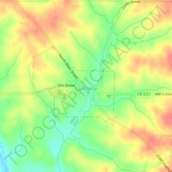
Name: La Motte topographic map, elevation, terrain.
Location: La Motte, Jackson County, Iowa, 52054, États-Unis d'Amérique (42.28963 -90.63216 42.30208 -90.61429)
Average elevation: 299 m
Minimum elevation: 265 m
Maximum elevation: 327 m