
Casti-Wergenstein topographic map
Interactive map
Click on the map to display elevation.
About this map
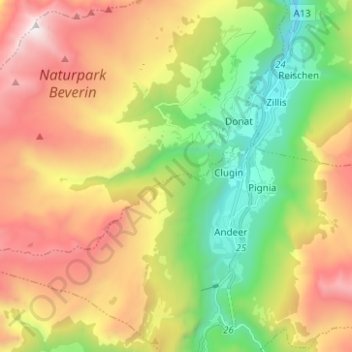
Name: Casti-Wergenstein topographic map, elevation, terrain.
Average elevation: 2,235 m
Minimum elevation: 1,234 m
Maximum elevation: 3,035 m
Other topographic maps
Click on a map to view its topography, its elevation and its terrain.
Mathon
Schweiz > Graubünden > Viamala > Muntogna da Schons > Donat
Mathon, Donat, Muntogna da Schons, Viamala, Graubünden, 7433, Schweiz
Average elevation: 1,520 m