
Village of Williamsville topographic map
Interactive map
Click on the map to display elevation.
About this map
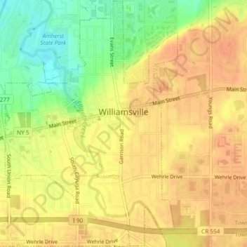
Name: Village of Williamsville topographic map, elevation, terrain.
Average elevation: 206 m
Minimum elevation: 181 m
Maximum elevation: 217 m
Other topographic maps
Click on a map to view its topography, its elevation and its terrain.
Onondaga Escarpment
United States > New York > Erie County > Village of Akron
Average elevation: 236 m