
Thank you for supporting this site ❤️
Make a donation
Make a donation
Gear up for your next adventure:
As an Amazon Associate, this site earns from qualifying purchases at no extra cost to you.
Romeral topographic map
Click on the map to display elevation.
Thank you for supporting this site ❤️
Make a donation
Make a donation
Gear up for your next adventure:
As an Amazon Associate, this site earns from qualifying purchases at no extra cost to you.
About this map
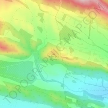
Name: Romeral topographic map, elevation, terrain.
Location: Romeral, Aibar, Comarca de Sangüesa, Navarra, 31400, España (42.59766 -1.32668 42.59776 -1.32658)
Average elevation: 536 m
Minimum elevation: 435 m
Maximum elevation: 697 m
Thank you for supporting this site ❤️
Make a donation
Make a donation
Gear up for your next adventure:
As an Amazon Associate, this site earns from qualifying purchases at no extra cost to you.