Geolocate

Mandwal topographic map

Click on the map to display elevation.

About this map

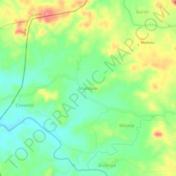
Name: Mandwal topographic map, elevation, terrain.

Location: Mandwal, Kotra Tehsil, Udaipur District, Rajasthan, India (24.18484 73.07525 24.22484 73.11525)

Average elevation: 276 m

Minimum elevation: 243 m

Maximum elevation: 324 m

Gear up for your next adventure:

🧷Tenacious Repair Tape - Instant fix for torn tents, jackets, or dry bags
🛰️Outdoor GPS Navigation - Navigation devices for remote and off-grid areas
🔋Rechargeable Batteries - Eco-friendly power for headlamps and older GPS units
🥤Hiking Water Bottles - Reusable bottles for hydration on the trail
🧣Neck Gaiters - Protects against wind and sun on exposed ridges and peaks

As an Amazon Associate, this site earns from qualifying purchases at no extra cost to you.