Geolocate

Grzybowice topographic map

Click on the map to display elevation.

About this map
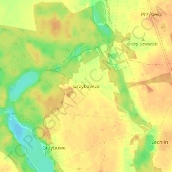
Name: Grzybowice topographic map, elevation, terrain.

Location: Grzybowice, gmina Skoki, Wągrowiec County, Greater Poland Voivodeship, 62-085, Poland (52.70051 17.10172 52.74051 17.14172)

Average elevation: 85 m

Minimum elevation: 63 m

Maximum elevation: 96 m

Other topographic maps

Click on a map to view its topography, its elevation and its terrain.

Gear up for your next adventure:

⛺Camping Shelters - Emergency and lightweight shelters for outdoor use
🍱Food Containers - Reusable containers for outdoor meals
🦯Walking Poles - Supportive poles for long-distance walking
🧰Survival Kits - Emergency tools for remote environments
🥄Titanium Camping Sporks - The ultimate lightweight utensil for trail meals

As an Amazon Associate, this site earns from qualifying purchases at no extra cost to you.