
Petrovo topographic map
Interactive map
Click on the map to display elevation.
About this map
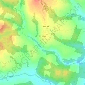
Name: Petrovo topographic map, elevation, terrain.
Average elevation: 205 m
Minimum elevation: 182 m
Maximum elevation: 233 m
Other topographic maps
Click on a map to view its topography, its elevation and its terrain.
Maloyaroslavets
Russia > Kaluga Oblast > Maloyaroslavetsky District
Maloyaroslavets, городское поселение Малоярославец, Maloyaroslavetsky District, Kaluga Oblast, Central Federal District, 249090, Russia
Average elevation: 171 m
Сляднево
Russia > Kaluga Oblast > Maloyaroslavetsky District
Сляднево, сельское поселение Юбилейный, Maloyaroslavetsky District, Kaluga Oblast, Central Federal District, Russia
Average elevation: 199 m