
Parc du Cinquantenaire - Jubelpark topographic map
Interactive map
Click on the map to display elevation.
About this map
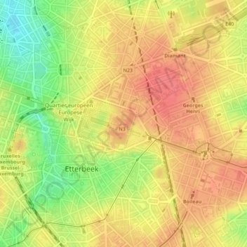
Name: Parc du Cinquantenaire - Jubelpark topographic map, elevation, terrain.
Average elevation: 76 m
Minimum elevation: 37 m
Maximum elevation: 100 m
Other topographic maps
Click on a map to view its topography, its elevation and its terrain.
Parc de Laeken - Park van Laken
Belgium > Brussels-Capital > Brussels > Laeken - Laken
Average elevation: 47 m