
Thank you for supporting this site ❤️
Make a donation
Make a donation
Gear up for your next adventure:
As an Amazon Associate, this site earns from qualifying purchases at no extra cost to you.
Saldes topographic map
Click on the map to display elevation.
Thank you for supporting this site ❤️
Make a donation
Make a donation
Gear up for your next adventure:
As an Amazon Associate, this site earns from qualifying purchases at no extra cost to you.
About this map
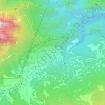
Name: Saldes topographic map, elevation, terrain.
Location: Saldes, Berguedà, Barcelona, Cataluña, 08697, España (42.20876 1.71495 42.24876 1.75495)
Average elevation: 1,344 m
Minimum elevation: 940 m
Maximum elevation: 2,424 m
Thank you for supporting this site ❤️
Make a donation
Make a donation
Gear up for your next adventure:
As an Amazon Associate, this site earns from qualifying purchases at no extra cost to you.