
Thank you for supporting this site ❤️
Make a donation
Make a donation
Gear up for your next adventure:
As an Amazon Associate, this site earns from qualifying purchases at no extra cost to you.
Province topographic map
Click on the map to display elevation.
Thank you for supporting this site ❤️
Make a donation
Make a donation
Gear up for your next adventure:
As an Amazon Associate, this site earns from qualifying purchases at no extra cost to you.
About this map
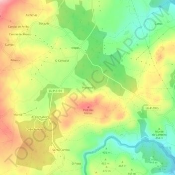
Name: Province topographic map, elevation, terrain.
Location: Province, Aspai, Outeiro de Rei, Lugo, Galice, 27299, Espagne (43.06055 -7.69039 43.10055 -7.65039)
Average elevation: 465 m
Minimum elevation: 379 m
Maximum elevation: 563 m
Thank you for supporting this site ❤️
Make a donation
Make a donation
Gear up for your next adventure:
As an Amazon Associate, this site earns from qualifying purchases at no extra cost to you.