
Elwood topographic map
Interactive map
Click on the map to display elevation.
About this map
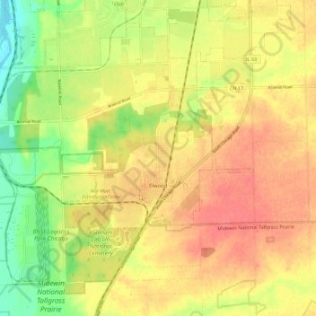
Name: Elwood topographic map, elevation, terrain.
Location: Elwood, Will County, Illinois, United States (41.37507 -88.18990 41.44720 -88.07778)
Average elevation: 189 m
Minimum elevation: 153 m
Maximum elevation: 214 m
Other topographic maps
Click on a map to view its topography, its elevation and its terrain.