
Niederfeulen topographic map
Interactive map
Click on the map to display elevation.
About this map
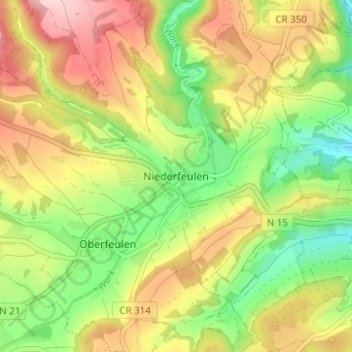
Name: Niederfeulen topographic map, elevation, terrain.
Location: Niederfeulen, Feulen, Canton Diekirch, 9175, Luxembourg (49.83547 6.02575 49.87547 6.06575)
Average elevation: 340 m
Minimum elevation: 229 m
Maximum elevation: 466 m