Geolocate

Kumberg topographic map

Click on the map to display elevation.

About this map
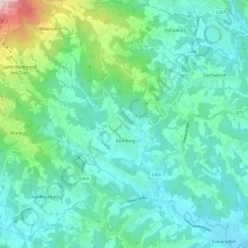
Name: Kumberg topographic map, elevation, terrain.

Location: Kumberg, Bezirk Graz-Umgebung, Styria, 8062, Austria (47.12888 15.50123 47.20062 15.59051)

Average elevation: 551 m

Minimum elevation: 413 m

Maximum elevation: 1,119 m

Other topographic maps

Click on a map to view its topography, its elevation and its terrain.

Dobl

Austria > Styria > Bezirk Graz-Umgebung > Dobl-Zwaring

Average elevation: 336 m

Thondorf

Austria > Styria > Bezirk Graz-Umgebung

Average elevation: 337 m

Schöckl

Austria > Styria > Bezirk Graz-Umgebung > St. Radegund

Average elevation: 1,136 m

Gear up for your next adventure:

📻Hand-Crank Emergency Radios - Stay updated on weather warnings in remote areas
🛌Sleeping Bags - Warm and packable sleeping bags for outdoor nights
🪢Paracord - Multi-purpose cord for camping and survival
🥼Base Layers - Thermal base layers for temperature regulation
📚UK Hiking Guidebooks - Detailed route descriptions for the Lake District, Peaks, and Highlands

As an Amazon Associate, this site earns from qualifying purchases at no extra cost to you.