
Steinheim topographic map
Interactive map
Click on the map to display elevation.
About this map
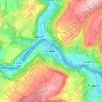
Name: Steinheim topographic map, elevation, terrain.
Location: Steinheim, Rosport-Mompach, Canton Echternach, 6585, Luxembourg (49.79826 6.45567 49.83826 6.49567)
Average elevation: 255 m
Minimum elevation: 152 m
Maximum elevation: 384 m