
Geldingadalsgos topographic map
Interactive map
Click on the map to display elevation.
About this map
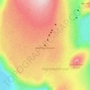
Name: Geldingadalsgos topographic map, elevation, terrain.
Location: Geldingadalsgos, Grindavíkurbær, Péninsule du Sud, Islande (63.88830 -22.27116 63.88840 -22.27106)
Average elevation: 250 m
Minimum elevation: 90 m
Maximum elevation: 374 m
Other topographic maps
Click on a map to view its topography, its elevation and its terrain.
Grindavík
Grindavík, Grindavíkurbær, Péninsule du Sud, 240, Islande
Average elevation: 27 m
Langihryggur
Langihryggur, Grindavíkurbær, Péninsule du Sud, Islande
Average elevation: 179 m