
Schmerbroich topographic map
Interactive map
Click on the map to display elevation.
About this map
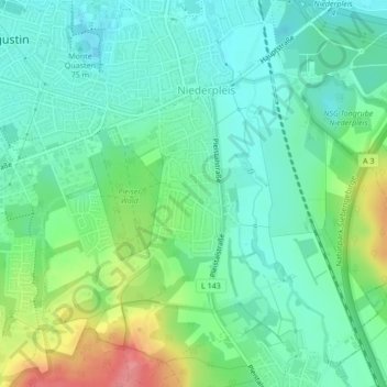
Name: Schmerbroich topographic map, elevation, terrain.
Average elevation: 84 m
Minimum elevation: 58 m
Maximum elevation: 145 m
Other topographic maps
Click on a map to view its topography, its elevation and its terrain.
Hangelar
Deutschland > Nordrhein-Westfalen > Rhein-Sieg-Kreis > Sankt Augustin
Hangelar, Sankt Augustin, Rhein-Sieg-Kreis, Nordrhein-Westfalen, Deutschland
Average elevation: 75 m
Birlinghoven
Deutschland > Nordrhein-Westfalen > Rhein-Sieg-Kreis > Sankt Augustin
Birlinghoven, Sankt Augustin, Rhein-Sieg-Kreis, Nordrhein-Westfalen, Deutschland
Average elevation: 106 m