

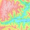
Bailing topographic map
Click on the map to display elevation.
About this map

Name: Bailing topographic map, elevation, terrain.
Location: Bailing, Lhasa, Xizang, China (29.25051 90.53618 29.29051 90.57618)
Average elevation: 3,660 m
Minimum elevation: 3,595 m
Maximum elevation: 4,024 m
Other topographic maps
Click on a map to view its topography, its elevation and its terrain.
Qüxü County
In the Tibetan language, the name means "water ditch." Qüxü County has a total area of 1,680 square kilometres (650 sq mi), with an average elevation of 3,650 metres (11,980 ft). The county is in the Yarlung Tsangpo valley, and is mostly relatively flat, but rises to the Nyainqêntanglha Mountains in the…
Average elevation: 4,514 m

Nyêmo County
"Nyemo" is the Tibetan word for "wheat". It is located in the middle section of the Brahmaputra, 140 kilometres (87 mi) from Lhasa. It is mainly agricultural and pastoral, with an area of 3,276 square kilometres (1,265 sq mi) and an average elevation of 4,000 metres (13,000 ft). The county seat is 3,809 metres…
Average elevation: 4,989 m