
Thank you for supporting this site ❤️
Make a donation
Make a donation
Gear up for your next adventure:
As an Amazon Associate, this site earns from qualifying purchases at no extra cost to you.
Sardinal topographic map
Click on the map to display elevation.
Thank you for supporting this site ❤️
Make a donation
Make a donation
Gear up for your next adventure:
As an Amazon Associate, this site earns from qualifying purchases at no extra cost to you.
About this map
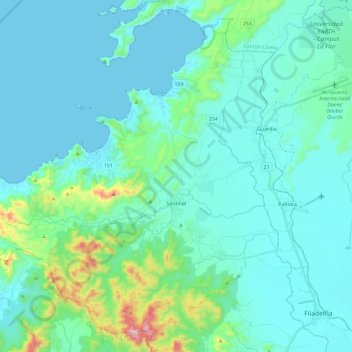
Name: Sardinal topographic map, elevation, terrain.
Location: Sardinal, Cantón de Carrillo, Guanacaste, 50503, Costa Rica (10.43180 -85.81198 10.63692 -85.57895)
Average elevation: 71 m
Minimum elevation: 0 m
Maximum elevation: 522 m
Thank you for supporting this site ❤️
Make a donation
Make a donation
Gear up for your next adventure:
As an Amazon Associate, this site earns from qualifying purchases at no extra cost to you.