Geolocate

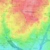
Trafalgar topographic map

Click on the map to display elevation.

About this map

Name: Trafalgar topographic map, elevation, terrain.

Location: Trafalgar, Chamberí, Madrid, Community of Madrid, 28010, Spain (40.42763 -3.70581 40.43867 -3.69575)

Average elevation: 683 m

Minimum elevation: 595 m

Maximum elevation: 717 m

Other topographic maps

Click on a map to view its topography, its elevation and its terrain.
Madrid

Spain > Community of Madrid > Madrid

Average elevation: 650 m

Gear up for your next adventure:

🎿Telescopic Trekking Poles - Reduces knee strain on steep topographic descents
🥾Walking Shoes - Lightweight walking shoes for countryside and coastal paths
🥼Base Layers - Thermal base layers for temperature regulation
🧤Hiking Gloves - Warm and durable gloves for cold-weather walks
🧣Neck Gaiters - Protects against wind and sun on exposed ridges and peaks

As an Amazon Associate, this site earns from qualifying purchases at no extra cost to you.