Geolocate

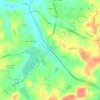
Fies topographic map

Click on the map to display elevation.

About this map

Name: Fies topographic map, elevation, terrain.

Location: Fies, Hopkins County, Kentucky, United States (37.30227 -87.39389 37.34227 -87.35389)

Average elevation: 122 m

Minimum elevation: 94 m

Maximum elevation: 153 m

Other topographic maps

Click on a map to view its topography, its elevation and its terrain.

Madisonville

United States > Kentucky > Hopkins County

Average elevation: 136 m

Nortonville

United States > Kentucky > Hopkins County

Average elevation: 133 m

Earlington

United States > Kentucky > Hopkins County

Average elevation: 147 m

Dawson Springs

United States > Kentucky > Hopkins County

Average elevation: 131 m

Madisonville

United States > Kentucky > Hopkins County

Average elevation: 136 m

Madisonville

United States > Kentucky > Hopkins County

Average elevation: 136 m

Nebo

United States > Kentucky > Hopkins County

Average elevation: 122 m

Gear up for your next adventure:

🔦Head Torches - Hands-free lighting for hiking and camping
📐Altimeters & Barometers - Tools for measuring altitude and air pressure
🔦Outdoor Torches - Reliable torches for night navigation
🎿Telescopic Trekking Poles - Reduces knee strain on steep topographic descents
🎒Hiking Daypacks - Compact backpacks ideal for short hikes and excursions

As an Amazon Associate, this site earns from qualifying purchases at no extra cost to you.