Geolocate

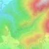
Banni topographic map

Click on the map to display elevation.

About this map

Name: Banni topographic map, elevation, terrain.

Location: Banni, Dharamshala, Kangra, Himachal Pradesh, 176057, India (32.15717 76.35530 32.19717 76.39530)

Average elevation: 1,156 m

Minimum elevation: 941 m

Maximum elevation: 1,676 m

Other topographic maps

Click on a map to view its topography, its elevation and its terrain.
Kareri

India > Himachal Pradesh > Dharamshala

Average elevation: 1,849 m

Balh

India > Himachal Pradesh > Dharamshala > Dharamshala

Average elevation: 1,906 m

Kareri

India > Himachal Pradesh > Dharamshala

Average elevation: 1,849 m

Kareri

India > Himachal Pradesh > Dharamshala

Average elevation: 1,849 m

Gear up for your next adventure:

👖Packable Overtrousers - Quick-deploy rain protection for legs in sudden storms
🧥Softshell Jackets - Breathable jackets for active outdoor use
🧦Merino Wool Hiking Socks - Moisture-wicking socks to prevent blisters during long mountain walks
🕶️Glacier Goggles - Maximum protection for high-altitude snow topography
📱Rugged Phone Cases - Heavy-duty protection for smartphones used as secondary GPS tools

As an Amazon Associate, this site earns from qualifying purchases at no extra cost to you.