
Gaoual Prefecture topographic map
Interactive map
Click on the map to display elevation.
About this map
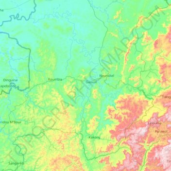
Name: Gaoual Prefecture topographic map, elevation, terrain.
Location: Gaoual Prefecture, Boké Region, Guinea (11.12695 -14.08121 12.32213 -12.68853)
Average elevation: 274 m
Minimum elevation: 40 m
Maximum elevation: 1,242 m
Other topographic maps
Click on a map to view its topography, its elevation and its terrain.