
Tha Khlong Town Municipality topographic map
Interactive map
Click on the map to display elevation.
About this map
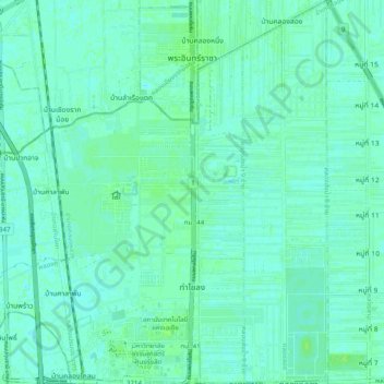
Name: Tha Khlong Town Municipality topographic map, elevation, terrain.
Average elevation: 4 m
Minimum elevation: 1 m
Maximum elevation: 9 m
Other topographic maps
Click on a map to view its topography, its elevation and its terrain.
Khlong Luang Town Municipality
Thailand > Pathum Thani Province > Khlong Luang District
Average elevation: 4 m